| Clopton | |
|---|---|
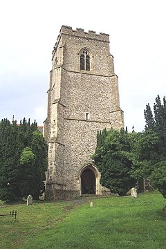
 Tower of St Mary's Church, Clopton | |
Location within Suffolk | |
| Population | 375 (2011 Census) |
| Civil parish |
|
| District | |
| Shire county | |
| Region | |
| Country | England |
| Sovereign state | United Kingdom |
| Post town | Woodbridge |
| Postcode district | IP13 |
| UK Parliament | |


Clopton is a village and civil parish in Suffolk. It is located between Ipswich and Debenham two kilometres north of Grundisburgh on the River Lark. The village is no larger than a series of houses either side of the B1078, surrounded by farm land. The village itself has no clear centre; houses and other buildings are concentrated around the four manors of Kingshall, Brendhall, Rousehall and Wascolies, all of which are mentioned in the Domesday Book of 1086.[1][2]
As of 2011, the population of the parish numbered 375 people.[3] The village previously had a school, which was built in 1875 and had capacity for 100 pupils with an average attendance of 56,[4] however it closed in the late 1930s.[1] Pupils instead attend schools in Grundisburgh or Woodbridge, with a bus service provided by Suffolk County Council.[5]
- ^ a b "Clopton Church – Village History". Church of St. Mary the Virgin, Clopton. Retrieved 3 March 2015.
- ^ "Manorial court books for Kingshall, Brendhall, Wascolies, and Rousehall in the parish of Clopton, Suffolk (England), 1600–1866". ArchiveGrid. Retrieved 24 April 2015.
- ^ "Clopton (Parish): Key Figures for 2011 Census: Key Statistics". Neighbourhood Statistics. Office for National Statistics. Retrieved 27 January 2015.
- ^ "Clopton Church – Clopton School". Church of St. Mary the Virgin, Clopton. Retrieved 3 March 2015.
- ^ "BBC – Domesday Reloaded: Schooling at Clopton". BBC – Domesday Reloaded. Archived from the original on 25 September 2015. Retrieved 3 March 2015.
