Coatzacoalcos | |
|---|---|
City and municipality | |
|
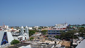
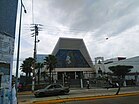
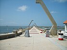
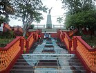
Top: Panoramic view of Coatzacoalcos's downtown; Middle: Olmec Archaeology Museum, Cathedral of Saint Joseph; Bottom: Coatzacoalcos jetty, stairways at the riverside front | |
| Nickname: La Ciudad de las Avenidas (The City of Avenues) | |
| Coordinates: 18°9′N 94°26′W / 18.150°N 94.433°W | |
| Country | Mexico |
| State | Veracruz |
| Founded | 1522 |
| Government | |
| • Municipal president | Amado Jesús Cruz Malpica MORENA |
| Area | |
• Municipality | 309.2 km2 (119.4 sq mi) |
| Highest elevation | 50 m (160 ft) |
| Lowest elevation | 0 m (0 ft) |
| Population (2020) | |
• Municipality | 310,698 |
| • Density | 1,004.8/km2 (2,602/sq mi) |
| • Seat | 212,540 |
| • Metro | 354,606 |
| • Metro density | 714.64/km2 (1,850.9/sq mi) |
| Time zone | UTC−6 (CST) |
| • Summer (DST) | UTC−5 (CDT) |
| Postal code | 96380 – 96599 |
| Area code | 921 |
| Website | www |
Coatzacoalcos (Spanish: [koatsakoˈalkos]; Nahuatl languages: Koatzakwalko; Zapotec: Niniashi; Popoluca: Puertu) is a major port city in the southern part of the Mexican state of Veracruz, mostly on the western side of the Coatzacoalcos River estuary, on the Bay of Campeche, on the southern Gulf of Mexico coast. The city serves as the municipal seat of the municipality of the same name. The city had a 2020 census population of 212,540, making it the third-largest city in the state after Veracruz and Xalapa. The municipality covers a surface area of 471.16 km2 (181.916 sq mi) and reported a population of 310,698 persons. The municipality population in 2015 was 319,187 a decrease of 9% over 2020.[1]
- ^ Censo Coatzacoalcos 2020 Archived 2022-07-26 at the Wayback Machine CEEIG


