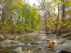
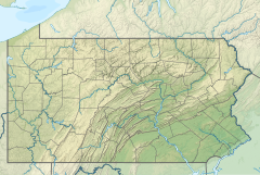
| Cobbs Creek | |
|---|---|
 Cobbs Creek near Nitre Hall | |
| Location | |
| Country | United States |
| State | Pennsylvania |
| Counties | Philadelphia, Montgomery, Delaware |
| Cities | Philadelphia, Upper Darby, Darby, Millbourne |
| Physical characteristics | |
| Source | Cobbs Creek |
| • location | Montgomery County, Pennsylvania, Montgomery County, Pennsylvania, United States |
| • coordinates | 40°00′54″N 75°19′32″W / 40.01500°N 75.32556°W |
| • elevation | 377 ft (115 m) |
| Mouth | Darby Creek |
• location | Darby, Pennsylvania, United States |
• coordinates | 39°54′23″N 75°15′11″W / 39.90639°N 75.25306°W |
• elevation | 0 ft (0 m) |
| Length | 11.8 mi (19.0 km) |
| Basin size | 100 sq mi (260 km2) |
| Discharge | |
| • location | Darby |
| • minimum | 195 cu ft/s (5.5 m3/s) |
| • maximum | 50,200 cu ft/s (1,420 m3/s) |
| Discharge | |
| • location | Darby |
| Basin features | |
| Tributaries | |
| • left | Naylors Run, Indian Creek, Mingo Creek |
| • right | Thomas Run Creek, Paschall Creek |
Cobbs Creek is an 11.8-mile-long (19.0 km)[1] tributary of Darby Creek in Delaware County, Pennsylvania, in the United States. It forms an approximate border between Montgomery County and Delaware County. After Cobbs Creek passes underneath Township Line Road (U.S. Route 1), it forms the border between Philadelphia County and Delaware County. It runs directly through the two sides of Mount Moriah Cemetery which spans the border of Southwest Philadelphia and Yeadon, Pennsylvania.[2] It later joins Darby Creek before flowing into the Delaware River.[3]
- ^ U.S. Geological Survey. National Hydrography Dataset high-resolution flowline data. The National Map Archived 2016-06-30 at the Wayback Machine, accessed April 1, 2011
- ^ Webster, J.P. (2014). Vanishing Philadelphia: Ruins of the Quaker City. Charleston, South Carolina: The History Press. p. 152. ISBN 978-1-62585-134-5. Retrieved 30 August 2019.
- ^ Cobb's Creek in the Days of the Old Powder Mill
