Coconut Grove | |
|---|---|
 Typical street in Coconut Grove, showing heavy vegetation characteristic of the hammock. | |
| Nickname: The Grove | |
 Coconut Grove neighborhood in Miami | |
| Coordinates: 25°43′N 80°15′W / 25.717°N 80.250°W | |
| Country | United States |
| State | Florida |
| County | Miami-Dade County |
| City | Miami |
| Settled | 1825 |
| Annexed into the City of Miami | 1925 |
| Subdistricts of Coconut Grove | Neighborhoods list
|
| Government | |
| • City of Miami Commissioner | Damian Pardo |
| • Miami-Dade Commissioners | Xavier L. Suarez |
| • House of Representatives | Vicki Lopez (R) |
| • State Senate | Ileana Garcia (R) |
| • U.S. House | Maria Elvira Salazar (R) |
| Area | |
• Total | 5.607 sq mi (14.52 km2) |
| Elevation | 13 ft (4 m) |
| Highest elevation | 24 ft (7 m) |
| Population (2010) | |
• Total | 20,076 |
| • Density | 8,006/sq mi (3,091/km2) |
| • Demonym | Grovite |
| Time zone | UTC−05 (EST) |
| ZIP Code | 33133 |
| Area code(s) | 305, 786 |
| Website | www.coconutgrove.com |
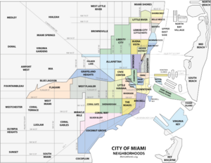
Coconut Grove, also known colloquially as “The Grove,” is an affluent and the oldest continuously inhabited neighborhood of Miami in Miami-Dade County, Florida. The neighborhood is roughly bounded by North Prospect Drive to the south, LeJeune Road to the west, South Dixie Highway (US 1) and Rickenbacker Causeway to the north, and Biscayne Bay to the east.[1] It is south of the neighborhoods of Brickell and The Roads and east of Coral Gables. The neighborhood's name has been sometimes spelled "Cocoanut Grove" but the definitive spelling "Coconut Grove" was established when the city was incorporated in 1919.[2]
What is today referred to as Coconut Grove was formed in 1925 when the city of Miami annexed two areas of about equal size, the city of Coconut Grove and most of the town of Silver Bluff. Coconut Grove approximately corresponds to the same area as the 33133 ZIP Code although the ZIP Code includes parts of Coral Way and Coral Gables[3] and a small portion of ZIP Code 33129.[4] The area is often referred to as "The Grove,” and locals take pride that Coconut Grove is one of the greenest areas of Miami.[5][6]
Coconut Grove is directly served by the Miami Metrorail at Coconut Grove and Douglas Road stations.
- ^ City of Miami official map Archived April 16, 2009, at the Wayback Machine
- ^ Blackman, E. V. Miami and Dade County, Florida. Washington, D.C.: Victor Rainbolt, 1921.
- ^ USNaviguide.com
- ^ "Demographics of Coconut Grove, Miami, Florida". city-data. Retrieved August 30, 2009.
- ^ https://www.academia.edu/26538827/Coconut_Grove_West_Grove_tree_canopy_variations_over_time Miami’s Coconut Grove – tree canopy variation over time, May 2016, Accessed 1 October 2016
- ^ http://milliontrees.miamidade.gov/library/miami-dade_utc-assessment_final-lr.pdf Miami-Dade Urban Tree Canopy Assessment 2016