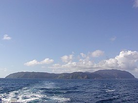
| Cocos Island National Park | |
|---|---|
 Cocos Island | |
| Location | Approximately 550 km (340 mi) off the shore of Costa Rica |
| Coordinates | 05°31′41″N 87°03′40″W / 5.52806°N 87.06111°W |
| Established | 1978 |
| Criteria | Natural: ix, x |
| Reference | 820 |
| Inscription | 1997 (21st Session) |
| Extensions | 2002 |
| Official name | Isla del Coco |
| Designated | 10 April 1998 |
| Reference no. | 940[1] |
Isla del Coco | |
|---|---|
 Isla del Coco district | |
| Country | |
| Province | Puntarenas |
| Canton | Puntarenas |
| Creation | 27 April 1970 |
| Area | |
• Total | 23.52 km2 (9.08 sq mi) |
| Elevation | 0 m (0 ft) |
| Time zone | UTC−06:00 |
| Postal code | 60110 |
Cocos Island (Spanish: Isla del Coco) is an island in the Pacific Ocean administered by Costa Rica, approximately 550 km (342 mi; 297 nmi) southwest of the Costa Rican mainland.[2] It constitutes the 11th[3] of the 15 districts of Puntarenas Canton of the Province of Puntarenas.[4][5] With an area of approximately 23.85 km2 (9.21 sq mi), the island is roughly rectangular in shape. It is the southernmost point of geopolitical North America if non-continental islands are included, and the only landmass above water on the Cocos tectonic plate.
The entirety of Cocos Island has been designated a Costa Rican National Park since 1978, and has no permanent inhabitants other than Costa Rican park rangers. As a result, it has been labelled as the world's largest uninhabited tropical island.[6] Surrounded by deep waters with counter-currents, Cocos Island is admired by scuba divers for its populations of hammerhead sharks, rays, dolphins and other large marine species. The wet climate and oceanic qualities give Cocos an ecological character that is not shared with either the Galápagos Archipelago or any of the other islands (for example, Malpelo, Gorgona or Coiba) in the eastern Pacific Ocean.[7] Because of the unique ecology of the island and its surrounding waters, Cocos Island National Park became a UNESCO World Heritage Site in 1997.[8] The island can only be reached by sea, which usually takes 36 to 48 hours.[9]
- ^ "Isla del Coco". Ramsar Sites Information Service. Archived from the original on 12 June 2018. Retrieved 25 April 2018.
- ^ Hogue, C. and Miller, S. 1981. Entomofauna of Cocos Island, Costa Rica. Atoll Research Bulletin 250: 1–29.
- ^ "Isla Coco". Archived from the original on 2007-09-29. Retrieved 2007-06-27.
- ^ "Declara oficial para efectos administrativos, la aprobación de la División Territorial Administrativa de la República N°41548-MGP". Sistema Costarricense de Información Jurídica (in Spanish). 19 March 2019. Archived from the original on 24 February 2024. Retrieved 26 September 2020.
- ^ División Territorial Administrativa de la República de Costa Rica (PDF) (in Spanish). Editorial Digital de la Imprenta Nacional. 8 March 2017. ISBN 978-9977-58-477-5. Archived (PDF) from the original on 16 September 2020. Retrieved 3 October 2020.
- ^ "The Times News (Idaho Newspaper) 2000-08-03". 3 August 2000.
- ^ Kirkendall, L. and Jordal, B. 2006. The bark and ambrosia beetles (Curculionidae, Scolytinae) of Cocos Island, Costa Rica and the role of mating systems in island zoogeography. Biological Journal of the Linnean Society 89(4): 729–743.
- ^ "Cocos Island National Par". United Nations Educational, Scientific, and Cultural Organization. Archived from the original on 24 December 2018. Retrieved 13 May 2021.
- ^ "Cocos Island - Dive with Sharks in Costa Rica". 2021-10-31. Archived from the original on 2023-07-12. Retrieved 2023-07-12.
