You can help expand this article with text translated from the corresponding article in French. (July 2014) Click [show] for important translation instructions.
|
| Col de Peyresourde | |
|---|---|
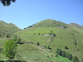
 The eastern approach to the Col de Peyresourde | |
| Elevation | 1,569 m (5,148 ft)[1] |
| Traversed by | D618 |
| Location | Haute-Garonne/Hautes-Pyrénées, France |
| Range | Pyrenees |
| Coordinates | 42°48′08″N 0°27′46″E / 42.80222°N 0.46278°E |
The Col de Peyresourde (Occitan: Còth de Pèira Sorda) (elevation 1,569 m (5,148 ft)) is a mountain pass in the central Pyrenees on the border of the department of Haute-Garonne and Hautes-Pyrénées in France. It is situated on the D618 road between Bagnères-de-Luchon and Arreau.
