| Colbinabbin Victoria | |||||||||||||||
|---|---|---|---|---|---|---|---|---|---|---|---|---|---|---|---|
 Colbinabbin Hotel | |||||||||||||||
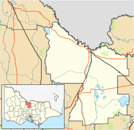
| Coordinates | 36°36′0″S 144°49′0″E / 36.60000°S 144.81667°E | ||||||||||||||
| Population | 285 (2021 census)[1] | ||||||||||||||
| Postcode(s) | 3559 | ||||||||||||||
| Location |
| ||||||||||||||
| LGA(s) | Shire of Campaspe | ||||||||||||||
| State electorate(s) | Euroa | ||||||||||||||
| Federal division(s) | Nicholls | ||||||||||||||
| |||||||||||||||
Colbinabbin /ˈkɒlbɪnæbən/ is a town in central Victoria, Australia. The name is derived from aboriginal meaning "the meeting of the black and red soils".[citation needed] At the 2011 census, Colbinabbin and the surrounding area had a population of 297.[1]
- ^ a b Australian Bureau of Statistics (31 October 2012). "Colbinabbin (State Suburb)". 2011 Census QuickStats. Retrieved 5 December 2014.
