| Collarenebri New South Wales | |
|---|---|
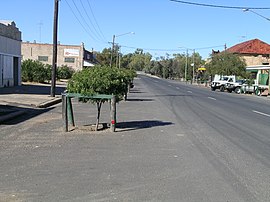
 Main street in 2008 | |
| Coordinates | 29°33′0″S 148°35′0″E / 29.55000°S 148.58333°E |
| Population | 650 (2016 census)[1] |
| Postcode(s) | 2833 |
| Elevation | 146 m (479 ft) |
| Location | |
| LGA(s) | Walgett Shire |
| State electorate(s) | Barwon |
| Federal division(s) | Parkes |

Collarenebri (/kɒlərɛnəbraɪ/ COLL-ə-REN-ə-bry) is a town in north western New South Wales, Australia. The town is in the Walgett Shire Local Government Area and is situated on the Barwon River approximately 75 kilometres (47 mi) northeast of Walgett and south west of Mungindi on the Gwydir Highway. It is 16 km (9.9 mi) from Pokataroo which was the nearest railway town prior to closure of the rail service there. The town is 146 metres (479 ft) above sea level. Collarenebri is one of three towns ending in 'BRI' in Northern New South Wales.
In the 2021 census, Collarenebri had a population of 638.[2]
Collarenebri is an indigenous word of the Gamilaraay galariinbaraay, meaning 'place of flowers' or 'eucalyptus blossoms'.[3][4] Collarenebri is well known for its flowers
- ^ Cite error: The named reference
ABSwas invoked but never defined (see the help page). - ^ "2021 Collarenebri, Census All persons QuickStats | Australian Bureau of Statistics". abs.gov.au. Retrieved 21 August 2024.
- ^ History of the Collarenebri Region/Collarenebri Central School: "Collarenebri Central School". Archived from the original on 18 July 2008. Retrieved 2 June 2008.
- ^ "Collarenebri". Geographical Names Register (GNR) of NSW. Geographical Names Board of New South Wales. Retrieved 12 July 2009.
