College Park East | |
|---|---|
 Sidney L. Buckwold Park | |
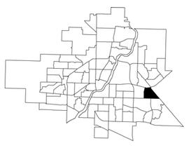
 College Park East location map | |
| Coordinates: 52°7′13″N 106°34′30″W / 52.12028°N 106.57500°W | |
| Country | |
| Province | |
| City | Saskatoon |
| Suburban Development Area | Lakewood |
| Neighbourhood | East College Park |
| Annexed | 1970-1974 |
| Construction | 1971-1980 |
| Government | |
| • Type | Municipal (Ward 8) |
| • Administrative body | Saskatoon City Council |
| • Councillor | Sarina Gersher |
| Area | |
| • Total | 1.61 km2 (0.62 sq mi) |
| Population (2021) | |
| • Total | 4,747 |
| • Average Income | $40,340 |
| Time zone | UTC-7 (MST) |
| • Summer (DST) | UTC-6 (CST) |
| Website | East College Park Community Association |
College Park East is a primarily residential neighbourhood located in the east-central part of Saskatoon, Saskatchewan, Canada. The majority of its residents live in single-family detached dwellings, with a sizeable minority of high-density, multiple-unit dwellings. As of 2021, the area is home to 4,747 residents with an average household size of 2.5 people. The neighbourhood is considered a middle-income area, with a median personal income of $40,340, a home ownership rate of 77.0%, and an average single family dwelling value of $324,875.[1]
- ^ "College Park East neighbourhood profile" (PDF). City of Saskatoon - Planning & Development. 2021. Archived (PDF) from the original on 2011-07-06. Retrieved 2010-04-07.