| Colorado National Monument | |
|---|---|
 | |
| Location | Mesa County, Colorado, United States |
| Nearest city | Grand Junction, CO |
| Coordinates | 39°02′33″N 108°41′10″W / 39.04250°N 108.68611°W |
| Area | 20,533 acres (83.09 km2)[1] |
| Established | May 24, 1911 |
| Visitors | 375,035 (in 2017)[2] |
| Governing body | National Park Service |
| Website | Colorado National Monument |

Colorado National Monument is a National Park Service unit near the city of Grand Junction, Colorado. Sheer-walled canyons cut deep into sandstone and granite–gneiss–schist rock formations. This is an area of desert land high on the Colorado Plateau, with pinyon and juniper forests on the plateau. The park hosts a wide range of wildlife, including red-tailed hawks, golden eagles, ravens, jays, desert bighorn sheep, and coyotes.[3] Activities include hiking, horseback riding, road bicycling, and scenic drives; a visitor center on the west side contains a natural history museum and gift shop. There are scenic views from trails, Rim Rock Drive, which winds along the plateau, and the campground.[4] Nearby are the Book Cliffs and the largest flat-topped mountain in the world, the Grand Mesa.
The monument's feature attraction is Monument Canyon, which runs the width of the park and includes rock formations such as Independence Monument, the Kissing Couple, and Coke Ovens. The monument includes 20,500 acres (32.0 sq mi; 83 km2), much of which has been recommended to Congress for designation as wilderness.
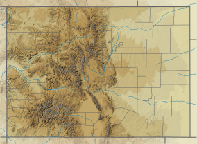
Interactive map of the Colorado National Monument
- ^ "Listing of acreage – December 31, 2011" (XLSX). Land Resource Division, National Park Service. Retrieved May 13, 2012. (National Park Service Acreage Reports)
- ^ "NPS Annual Recreation Visits Report". National Park Service. Retrieved April 9, 2018.
- ^ Colorado Division of Wildlife. http://wildlife.state.co.us/Education/TeacherResources/ColoradoWildlifeCompany/ColoradoNatlMonument.htm Archived 2011-07-18 at the Wayback Machine, accessed 8-03-09
- ^ Brachfeld, Aaron (September 2015). "Sunset for Colorado National Monument?". the Meadowlark Herald. No. September. the Meadowlark Herald. Retrieved September 16, 2015.

