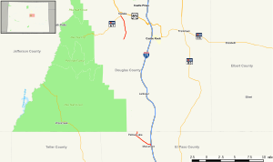
 Map of central Colorado with SH 105 highlighted in red | ||||
| Route information | ||||
| Maintained by CDOT | ||||
| Length | 9.238 mi[1] (14.867 km) | |||
| Major junctions | ||||
| South end | ||||
| North end | ||||
| Location | ||||
| Country | United States | |||
| State | Colorado | |||
| Counties | El Paso, Douglas | |||
| Highway system | ||||
| ||||
| ||||
State Highway 105 (SH 105) is a state highway that runs partially from I-25 in Monument to SH 67 (Manhart Avenue) in Sedalia. The highway serves the communities of Monument and Palmer Lake and the unincorporated areas of Douglas and El Paso counties. Several former sections have been deleted from the state highway system since its inception, thus leading to north and south sections of the current highway.
- ^ "SH 105 Inventory Form" (PDF). Colorado Department of Transportation. Retrieved January 22, 2022.
