Columbia, Maryland | |
|---|---|
 Aerial view of Downtown Columbia | |
| Motto: "The Next America!"[1] | |
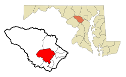
 Location of Columbia, Maryland | |
| Coordinates: 39°12′13″N 76°51′25″W / 39.20361°N 76.85694°W | |
| Country | |
| State | |
| County | Howard |
| Founded | June 21, 1967[2] |
| Founded by | James Rouse |
| Named for | Columbia (personification) |
| Area | |
• Total | 32.19 sq mi (83.37 km2) |
| • Land | 31.93 sq mi (82.71 km2) |
| • Water | 0.26 sq mi (0.66 km2) |
| Elevation | 407 ft (124 m) |
| Population (2020) | |
• Total | 104,681 |
| • Density | 3,278.04/sq mi (1,265.68/km2) |
| The CDP includes areas not part of Columbia proper as defined by the Columbia Association. | |
| Time zone | UTC−5 (Eastern (EST)) |
| • Summer (DST) | UTC−4 (EDT) |
| ZIP Codes | 21044-21046 |
| Area codes | 410, 443, 667 |
| FIPS code | 24-19125 |
| GNIS feature ID | 0590002 |
| Website | columbiaassociation.org |
Columbia is a census-designated place in Howard County, Maryland, United States. It is a planned community consisting of 10 self-contained villages. The census-designated place had a population of 104,681 at the 2020 census, making it the second most populous community in Maryland after Baltimore.[4][5] Columbia, located between Baltimore and Washington, D.C., is officially part of the Baltimore metropolitan area.
Columbia proper consists only of that territory governed by the Columbia Association, but larger areas are included under its name by the U.S. Postal Service and the Census Bureau. These include several other communities which predate Columbia, including Simpsonville, Atholton, and in the case of the census, part of Clarksville. Columbia began with the idea that a city could enhance its residents' quality of life. Developer James Rouse attempted to create the new community in terms of human values, rather than economics and engineering. Opened in 1967, Columbia was intended to not only eliminate the inconveniences of then-current subdivision design, but also eliminate racial, religious and class segregation.[6]
- ^ Levinson, David M. (2003). "The Next America Revisited". Journal of Planning Education and Research. 22 (329): 329–344. doi:10.1177/0739456X03022004001. hdl:11299/179914. S2CID 13196176.
- ^ "Columbia Archives". Columbia Association. Archived from the original on February 2, 2014. Retrieved January 23, 2014.
- ^ "2020 U.S. Gazetteer Files". United States Census Bureau. Archived from the original on March 5, 2023. Retrieved April 26, 2022.
- ^ "QuickFacts - Columbia CDP, Maryland". United States Census Bureau. n.d. Archived from the original on November 17, 2022. Retrieved November 11, 2022.
- ^ "Age and Sex: 2015 American Community Survey 1-Year Estimates (S0101): All places within Maryland". American Factfinder. U.S. Census Bureau. Archived from the original on February 13, 2020. Retrieved August 1, 2017.
- ^ Galambos, Louis (2011). The Creative Society-and the Price Americans Paid for It. Cambridge University Press. p. 160. ISBN 978-1107600997.

