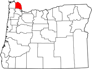
Columbia County | |
|---|---|
 Columbia County Courthouse in St. Helens | |
 Location within the U.S. state of Oregon | |
 Oregon's location within the U.S. | |
| Coordinates: 45°57′N 123°05′W / 45.95°N 123.08°W | |
| Country | |
| State | |
| Founded | January 16, 1854 |
| Named for | Columbia River |
| Seat | St. Helens |
| Largest city | St. Helens |
| Area | |
• Total | 688 sq mi (1,780 km2) |
| • Land | 657 sq mi (1,700 km2) |
| • Water | 31 sq mi (80 km2) 4.5% |
| Population (2020) | |
• Total | 52,589 |
• Estimate (2023) | 53,880 |
| • Density | 75/sq mi (29/km2) |
| Time zone | UTC−8 (Pacific) |
| • Summer (DST) | UTC−7 (PDT) |
| Congressional district | 1st |
| Website | www |
Columbia County is one of the 36 counties in the U.S. state of Oregon. As of the 2020 census, the population was 52,589.[1] The county seat is St. Helens.
- ^ "State & County QuickFacts". United States Census Bureau. Retrieved May 17, 2023.