Native name: Inis Uí Mhaolchluiche | |
|---|---|
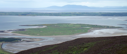
 Overview from Knocknarea | |
| Geography | |
| Location | Atlantic Ocean |
| Coordinates | 54°17′46″N 8°35′17″W / 54.2962°N 8.588°W |
| Area | 1.62 km2 (0.63 sq mi) |
| Administration | |
| Province | Connacht |
| County | Sligo |
| Demographics | |
| Population | 1 (2022)[1] |

Coney Island or Inishmulclohy (Irish: Inis Uí Mhaolchluiche)[2] is an island in Sligo Bay, Ireland. It lies across the mouth of Sligo Harbour, between Rosses Point and the Coolera Peninsula, and can be reached from the latter via a tidal causeway. The Irish name means "O'Mulclohy's island", in reference to a once powerful local family,[3] while the English name means "island of rabbits".
- ^ Population of Inhabited Islands Off the Coast (Report). Central Statistics Office. 2023. Retrieved 29 June 2023.
- ^ "Inis Uí Mhaolchluiche/Inishmulclohy or Coney Island". Placenames Database of Ireland. Government of Ireland - Department of Arts, Heritage and the Gaeltacht and Dublin City University. Retrieved 1 October 2018.
- ^ Woulfe, Patrick (1923). Sloinnte Gaedheal is Gall: Irish Names and Surnames. Dublin: M. H. Gill & Son. p. 607.
