| Coogee Sydney, New South Wales | |||||||||||||||
|---|---|---|---|---|---|---|---|---|---|---|---|---|---|---|---|
 Coogee Beach | |||||||||||||||
 | |||||||||||||||
| Population | 14,634 (2021 census)[1] | ||||||||||||||
| • Density | 7,700/km2 (19,900/sq mi) | ||||||||||||||
| Established | 1838[2] | ||||||||||||||
| Postcode(s) | 2034 | ||||||||||||||
| Elevation | 27 m (89 ft) | ||||||||||||||
| Area | 1.9 km2 (0.7 sq mi) | ||||||||||||||
| Location | 8 km (5 mi) south-east of Sydney CBD | ||||||||||||||
| LGA(s) | City of Randwick | ||||||||||||||
| State electorate(s) | Coogee | ||||||||||||||
| Federal division(s) | Kingsford Smith | ||||||||||||||
| |||||||||||||||


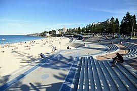
Coogee (/ˈkʊdʒi/) is a beachside suburb in the Eastern Suburbs of Sydney, New South Wales, Australia, eight kilometres south-east of the Sydney central business district.
The Tasman Sea and Coogee Bay along with Coogee Beach lie towards the eastern side of the suburb. The boundaries of Coogee are formed mainly by Clovelly Road, Carrington Road and Rainbow Street, with arbitrary lines drawn to join these thoroughfares to the coast in the north-east and south-east corners.
- ^ Australian Bureau of Statistics (27 June 2017). "Coogee (State Suburb)". 2016 Census QuickStats. Retrieved 21 December 2017.
- ^ "History of Coogee".