| Cookes Range | |
|---|---|
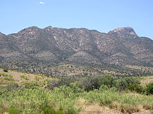
Eastern side of Cookes Range | |
| Highest point | |
| Peak | Cookes Peak |
| Elevation | 8,408 ft (2,563 m) |
| Coordinates | 32°32′10″N 107°43′54″W / 32.5360°N 107.7316°W |
| Dimensions | |
| Length | 17 mi (27 km) N-S |
| Width | 8 mi (13 km) |
| Geography | |
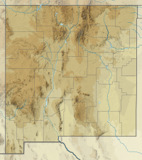
Cookes Range in New Mexico | |
| Country | United States |
| State | New Mexico |
| Region | ((northwest)-Chihuahuan Desert) |
| County | Luna |
| Settlement | Deming, Nutt and Lake Valley |
| Borders on | Whitehorse Mountain-NW Mimbres Mountains-N Good Sight Mountains-ESE Deming, NM & Florida Mtns-S |
| Topo map | USGS Massacre Peak |

The Cookes Range (Cooke's Range, Cooks Range or Cook's Range) is a small, 17-mi (27 km) long[1] mountain range in northern Luna County, New Mexico, which extends slightly north into southeastern Grant County. The range is a southern continuation of the Mimbres Mountains, itself the southeast portion of the extensive north–south running Black Range. The Cookes Range is surrounded by lower elevation areas of the northwest Chihuahuan Desert.
- ^ New Mexico Atlas & Gazetteer, DeLorme, c. 2009, p. 44-45.
