| Coquille River | |
|---|---|
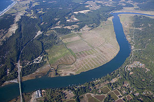
 Aerial view of the Coquille near its mouth | |
| Location | |
| Country | United States |
| State | Oregon |
| County | Coos |
| Physical characteristics | |
| Source | Southern Oregon Coast Range |
| • location | Myrtle Point |
| • coordinates | 43°04′49″N 124°08′28″W / 43.08028°N 124.14111°W[1] |
| • elevation | 17 ft (5.2 m)[2] |
| Mouth | Pacific Ocean |
• location | Bandon, Oregon |
• coordinates | 43°07′25″N 124°25′48″W / 43.12361°N 124.43000°W[1] |
• elevation | 0 ft (0 m)[1] |
| Length | 36.3 mi (58.4 km)[3] |
| Basin size | 1,059 sq mi (2,740 km2)[3] |
| Discharge | |
| • average | 4,526 cu ft/s (128.2 m3/s)[4] |
The Coquille River /koʊˈkiːl/ is a stream, about 36 miles (58 km) long, in southwestern Oregon in the United States. It drains a mountainous area of 1,059 square miles (2,740 km2) of the Southern Oregon Coast Range into the Pacific Ocean. Its watershed is between that of the Coos River to the north and the Rogue River to the south.[3][5]
- ^ a b c "Coquille River". Geographic Names Information System (GNIS). United States Geological Survey. November 28, 1980. Retrieved December 3, 2009.
- ^ Source elevation derived from Google Earth search using GNIS source coordinates.
- ^ a b c "Introduction to the Coquille Watershed". Coquille Watershed Association. Archived from the original on November 17, 2016. Retrieved December 3, 2009.
- ^ Palmer, Tim (2014). Field Guide to Oregon Rivers. Corvallis: Oregon State University Press. pp. 109–12. ISBN 978-0-87071-627-0.
- ^ Cite error: The named reference
DeLormewas invoked but never defined (see the help page).
