Coronado, California | |
|---|---|
 Hotel del Coronado in December 2008 | |
| Nickname: "The Crown City" | |
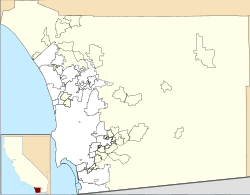
 Location of Coronado in San Diego County, California | |
| Coordinates: 32°40′41″N 117°10′21″W / 32.67806°N 117.17250°W | |
| Country | |
| State | |
| County | |
| Incorporated | December 11, 1890[1] |
| Government | |
| • Type | Mayor-council |
| • Mayor | Richard Bailey (R)[2] |
| Area | |
• Total | 32.50 sq mi (84.17 km2) |
| • Land | 7.80 sq mi (20.22 km2) |
| • Water | 24.69 sq mi (63.96 km2) 75.72% |
| Elevation | 16 ft (5 m) |
| Population (2020) | |
• Total | 20,192 |
| • Density | 2,587.06/sq mi (998.82/km2) |
| Time zone | UTC-8 (Pacific) |
| • Summer (DST) | UTC-7 (PDT) |
| ZIP codes | 92118, 92178 |
| Area code | 619 |
| FIPS code | 06-16378 |
| GNIS feature IDs | 1660513, 2410233 |
| Website | www |
Coronado (Spanish for "Crowned") is a resort city in San Diego County, California, United States, across San Diego Bay from downtown San Diego.[5] It was founded in the 1880s and incorporated in 1890. Its population was 20,192 in 2020,[6] down from 24,697 in 2010.[7][8]
Coronado is a tied island which is connected to the mainland by a tombolo (a sandy isthmus) called Silver Strand. Along the coast of Southern California lies four islands that were spotted by Sebastian Vizcaino and his crew. They named them “Los Coronados.” In the mid-1880s, businessmen bought the peninsula near Los Coronados with hopes to turn it into a resort. Later in 1886, the owners of this peninsula hosted a naming contest with the people resulting in the name “Miramar” winning, which was soon overturned due to the public not being satisfied with the name, so they borrowed from their cousin islands “Los Coronados” and named it “Coronado.” [9]The explorer Sebastian Vizcaino drew its first map in 1602. Coronado is Spanish term for "crowned" and thus it is nicknamed The Crown City. Its name is derived from the Coronado Islands, an offshore Mexican archipelago.[10] Three ships of the United States Navy have been named after the city, including USS Coronado.
- ^ "California Cities by Incorporation Date". California Association of Local Agency Formation Commissions. Archived from the original (Word) on November 3, 2014. Retrieved August 25, 2014.
- ^ "Coronado's Bachelor Mayor Up for Bid: Junior League Auctioning Dates". Times of San Diego. November 28, 2017. Retrieved May 2, 2020.
- ^ "2020 U.S. Gazetteer Files". United States Census Bureau. Retrieved October 30, 2021.
- ^ "Coronado". Geographic Names Information System. United States Geological Survey, United States Department of the Interior.
- ^ "Best places for the rich and single". CNN. July 13, 2009. Archived from the original on March 3, 2010. Retrieved April 30, 2010.
- ^ "Index of /programs-surveys/decennial/2020/data/01-Redistricting_File--PL_94-171/California". www2.census.gov. Retrieved February 12, 2023.
- ^ "2010 Census P.L. 94-171 Summary File Data". United States Census Bureau.
- ^ "Census Bureau's acknowledgment or miscoding some of Coronado's & San Diego's census blocks" (PDF). Retrieved September 2, 2011.
- ^ "The intriguing stories behind the names of some of San Diego's most well-known landmarks". San Diego Union-Tribune. December 10, 2023. Retrieved October 29, 2024.
- ^ Salley, Harold E. (1977). History of California Post Offices, 1849-1976. The Depot. ISBN 0-9601558-1-3.


