| Cotacachi Cayapas Reserve | |
|---|---|
 Cotacachi volcano, the park's namesake | |
| Location | Ecuador Imbabura Province, Esmeraldas Province |
| Coordinates | 0°35′0″N 78°41′0″W / 0.58333°N 78.68333°W |
| Area | 2044.2 km2 |
| Established | 1968 |
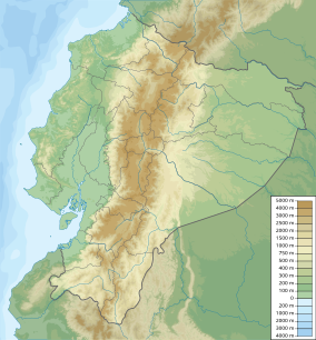
Cotacachi Cayapas Reserve contains 752,235 acres (3,044 km2) of land and is located in the Imbabura and Esmeraldas provinces of Ecuador 87 miles (140 km) from Quito. Elevations in the reserve range from about 300 metres (980 ft) in the west to Cotacachi Volcano which reaches an elevation of 4,944 metres (16,220 ft) in the southeast.[1] This nature reserve is partly rainforest. The park is a mix of many biological zones but the Andean (average 15 C) and Sub-tropical (average 25) zones are most common. The symbol of the reserve is a condor. This is one of the many protected areas in Ecuador.
This reserve is a part of the Ecuadorian system of reserves and preserves and extends from the mountains of the Sierra to the western edge of the coastal rainforest in the Esmeraldas region. This region has not been extensively farmed and replanted with eucalyptus or pine trees, as so much of the interandean highlands have been, so the preservation of the plant species here is a very important effort. The plants here have evolved adaptations to high altitude (reduced water availability, low temperatures and high winds), but since the conditions here are not as severe as those at higher altitudes, the adaptations of these plants are not as extreme as those of the paramo, at 3600–4800 meters.
- ^ "Reserva Ecologica Cotacachi Caypas", http://www.birdlist.org/national-parks/reserva-ecologica-cotacachi-cayapas/reserva-ecologica-cotacachi-cayapas.htm Archived 2017-06-11 at the Wayback Machine, accessed 7 Jul 20`17
