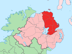
County Antrim
| |
|---|---|
| Nickname: The Glens County | |
| Motto(s): | |
 | |
| Coordinates: 54°51′54″N 6°16′48″W / 54.865°N 6.280°W | |
| Country | United Kingdom |
| Region | Northern Ireland |
| Province | Ulster |
| Established | c. 1400 |
| County town | Antrim |
| Area | |
• Total | 1,192 sq mi (3,086 km2) |
| • Rank | 9th |
| Highest elevation (Trostan) | 1,808 ft (551 m) |
| Population (2021) | 651,321 |
| • Rank | 2nd |
| Time zone | UTC±0 (GMT) |
| • Summer (DST) | UTC+1 (BST) |
| Postcode area | |
| Contae Aontroma is the Irish name; Coontie Antrìm,[2] Countie Antrim,[3] Coontie Anthrim[4] and Coonty Entrim[5] are Ulster-Scots names. | |
County Antrim (named after the town of Antrim, from Irish Aontroim, meaning 'lone ridge')[6] is one of the six counties of Northern Ireland, located within the historic province of Ulster. Adjoined to the north-east shore of Lough Neagh, the county covers an area of 3,086 square kilometres (1,192 sq mi) and has a population of 651,321,[7] as of the 2021 census. County Antrim has a population density of 211 people per square kilometre or 546 people per square mile.[8] It is also one of the thirty-two traditional counties of Ireland.
The Glens of Antrim offer isolated rugged landscapes, the Giant's Causeway is a unique landscape and a UNESCO World Heritage Site, Bushmills produces whiskey, and Portrush is a popular seaside resort and night-life area. The majority of Belfast, the capital city of Northern Ireland, is in County Antrim, with the remainder being in County Down.
According to the 2001, 2011, and 2021 censuses it is currently one of only two counties of the Island of Ireland in which a plurality or majority of the population are from a Protestant background. The other is County Down to the south.
- ^ Northern Ireland General Register Office (1975). "Table 1: Area, Buildings for Habitation and Population, 1971". Census of Population 1971; Summary Tables (PDF). Belfast: HMSO. p. 1. Archived (PDF) from the original on 23 July 2019. Retrieved 28 August 2019.
- ^ Bonamargy Friary Guide Archived 30 August 2011 at the Wayback Machine Department of the Environment.
- ^ North-South Ministerial Council: 2004 Annual Report in Ulster Scots Archived 2 September 2012 at the Wayback Machine
- ^ 2008 annual report in Ulster-Scots Archived 3 July 2013 at the Wayback Machine Tourism Ireland.
- ^ The Ulster-Scot, June 2011 Archived 1 September 2011 at the Wayback Machine Charlie 'Tha Poocher' Rennals.
- ^ Postal Towns/Bailte Poist Archived 7 February 2012 at the Wayback Machine, Northern Ireland Place-name Project. Queen's University Belfast. Retrieved 8 March 2012.
- ^ "Get data for your table | NISRA Flexible Table Builder". build.nisra.gov.uk. Archived from the original on 19 July 2023. Retrieved 19 July 2023.
- ^ Divide the population of County Antrim (618,108) by the area (3086 km2)
