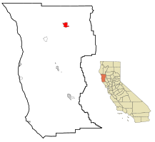
Covelo | |
|---|---|
 Downtown Covelo c. 1920 | |
 Location in Mendocino County and the state of California | |
| Coordinates: 39°47′35″N 123°14′53″W / 39.79306°N 123.24806°W | |
| Country | |
| State | |
| County | Mendocino |
| Area | |
• Total | 7.14 sq mi (18.49 km2) |
| • Land | 7.09 sq mi (18.38 km2) |
| • Water | 0.04 sq mi (0.11 km2) 0.60% |
| Elevation | 1,398 ft (426 m) |
| Population | |
• Total | 1,394 |
| • Density | 196.48/sq mi (75.86/km2) |
| Time zone | UTC-8 (Pacific (PST)) |
| • Summer (DST) | UTC-7 (PDT) |
| ZIP code | 95428 |
| Area code | 707 |
| FIPS code | 06-16728 |
| GNIS feature ID | 0277603 |
Covelo (/ˈkoʊvəloʊ/ KOH-və-loh) is a census-designated place (CDP) in Mendocino County, California, United States. Covelo is located 14 miles (23 km) east-northeast of Laytonville,[4] at an elevation of 1,398 feet (426 m).[2] The population was 1,394 at the 2020 census,[3] up from 1,255 at the 2010 census. 405 acres (1.64 km2) of Covelo is part of the Round Valley Indian Reservation.
- ^ "2021 U.S. Gazetteer Files: California". United States Census Bureau. Retrieved August 2, 2022.
- ^ a b U.S. Geological Survey Geographic Names Information System: Covelo, California
- ^ a b "P1. Race – Covelo CDP, California: 2020 DEC Redistricting Data (PL 94-171)". U.S. Census Bureau. Retrieved August 2, 2022.
- ^ Durham, David L. (1998). California's Geographic Names: A Gazetteer of Historic and Modern Names of the State. Clovis, Calif.: Word Dancer Press. p. 43. ISBN 1-884995-14-4.