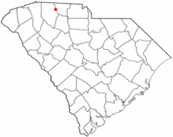
Cowpens, South Carolina | |
|---|---|
 Location of Cowpens, South Carolina | |
| Coordinates: 35°0′58″N 81°48′15″W / 35.01611°N 81.80417°W | |
| Country | United States |
| State | South Carolina |
| County | Spartanburg |
| Area | |
| • Total | 2.29 sq mi (5.94 km2) |
| • Land | 2.29 sq mi (5.94 km2) |
| • Water | 0.00 sq mi (0.00 km2) |
| Elevation | 860 ft (262 m) |
| Population | |
| • Total | 2,023 |
| • Density | 881.48/sq mi (340.35/km2) |
| Time zone | UTC-5 (Eastern (EST)) |
| • Summer (DST) | UTC-4 (EDT) |
| ZIP code | 29330 |
| Area codes | 864, 821 |
| FIPS code | 45-17260[3] |
| GNIS feature ID | 1247411[4] |
| Website | www.townofcowpens.com |
Cowpens is a town in Spartanburg County, South Carolina, United States. The population was 2,162 at the 2010 census.[5] The town was chartered February 20, 1880, and was incorporated in 1900.[6]
- ^ "ArcGIS REST Services Directory". United States Census Bureau. Retrieved October 15, 2022.
- ^ Cite error: The named reference
USCensusDecennial2020CenPopScriptOnlywas invoked but never defined (see the help page). - ^ "U.S. Census website". United States Census Bureau. Retrieved January 31, 2008.
- ^ "US Board on Geographic Names". United States Geological Survey. October 25, 2007. Retrieved January 31, 2008.
- ^ "Race, Hispanic or Latino, Age, and Housing Occupancy: 2010 Census Redistricting Data (Public Law 94-171) Summary File (QT-PL), Cowpens town, South Carolina". United States Census Bureau. Retrieved August 16, 2011.
- ^ One or more of the preceding sentences incorporates text from a publication now in the public domain: Chisholm, Hugh, ed. (1911). "Cowpens". Encyclopædia Britannica. Vol. 7 (11th ed.). Cambridge University Press. p. 348.