| Cowpens National Battlefield | |
|---|---|
| Location | Cherokee County, South Carolina, United States |
| Nearest city | Gaffney, South Carolina |
| Coordinates | 35°08′12″N 81°49′05″W / 35.13667°N 81.81806°W |
| Area | 842 acres (341 ha)[1] |
| Established | March 4, 1929[2] |
| Visitors | 212,534 (in 2022) |
| Governing body | National Park Service |
| Website | Cowpens National Battlefield |
Cowpens National Battlefield | |
| Nearest city | Chesnee, South Carolina |
| Area | 178 acres (72 ha) |
| Built | 1781 |
| NRHP reference No. | 66000072[3] |
| Added to NRHP | October 15, 1966 |
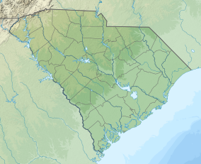
Cowpens National Battlefield is a unit of the National Park Service just east of Chesnee, South Carolina, and near the state line with North Carolina.[4][5] It preserves a major battlefield of the American Revolutionary War.

Brigadier General Daniel Morgan won the Battle of Cowpens, a decisive Revolutionary War victory over British Lieutenant Colonel Banastre Tarleton on January 17, 1781. It is considered one of Morgan's most memorable victories and one of Tarleton's most memorable defeats.
Established as Cowpens National Battlefield Site March 4, 1929; transferred from the War Department August 10, 1933; redesignated April 11, 1972. Listed on the National Register of Historic Places on October 15, 1966.[3] Area: 841.56 acres (3.41 km2), Federal: 790.9 acres (3.2 km2), Nonfederal: 50.66 acres (205,010 m2).
The visitor center features a museum with exhibits about the American Revolution and the battle, including a fiber-optic map that illustrates the Southern Campaign of the American Revolution and the battle, a walking tour of the battlefield itself, and the reconstructed log cabin of one Robert Scruggs, who had farmed the land before the establishment of the park.
- ^ "Listing of acreage – December 31, 2020" (XLSX). Land Resource Division, National Park Service. Retrieved 2021-08-15. (National Park Service Acreage Reports)
- ^ "Park Anniversaries". Retrieved 13 August 2021.
- ^ a b "National Register Information System". National Register of Historic Places. National Park Service. July 9, 2010.
- ^ Brown, Lenard (December 1976). "Cowpens National Battlefield" (PDF). National Register of Historic Places - Nomination and Inventory. Retrieved 23 June 2012.
- ^ "Cowpens National Battlefield, Cherokee County (jct. of S.C. Hwys. 11 & 110, Chesnee vicinity)". National Register Properties in South Carolina. South Carolina Department of Archives and History. Retrieved 23 June 2012.

