| Coyote Creek | |
|---|---|
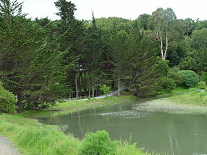
 Coyote Creek flowing through Tam Valley | |
| Location | |
| Country | United States |
| State | California |
| Region | Marin County |
| Physical characteristics | |
| Source | |
| • location | Coyote Ridge |
| • coordinates | 37°52′06″N 122°32′52″W / 37.86833°N 122.54778°W[1] |
| • elevation | 700 ft (210 m) |
| Mouth | Richardson's Bay |
• location | Tam Valley, California |
• coordinates | 37°52′59″N 122°31′08″W / 37.88306°N 122.51889°W[1] |
• elevation | 0 ft (0 m)[1] |

Coyote Creek is a stream in the Richardson Bay watershed, draining Tamalpais-Homestead Valley, California (Tam Valley) eastward into Richardson Bay, Marin County, California, United States. The stream originates on Coyote Ridge and flows 2.5 miles (4.0 km) to the bay at the south end of Bothin Marsh.[1][2]
- ^ a b c d U.S. Geological Survey Geographic Names Information System: Coyote Creek
- ^ Durham, David L. (1998). Durham's Place Names of California's San Francisco Bay Area: Includes Marin, San Francisco, San Mateo, Contra Costa, Alameda, Solano & Santa Clara counties. Word Dancer Press, Sanger, California. p. 620. ISBN 1-884995-14-4. Retrieved Jan 13, 2010.