Crawford County | |
|---|---|
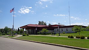
 Crawford County Building in Grayling | |
 Location within the U.S. state of Michigan | |
 Michigan's location within the U.S. | |
| Coordinates: 44°41′N 84°37′W / 44.68°N 84.61°W | |
| Country | |
| State | |
| Founded | 1840[1] |
| Named for | William Crawford |
| Seat | Grayling |
| Largest city | Grayling |
| Area | |
• Total | 563 sq mi (1,460 km2) |
| • Land | 556 sq mi (1,440 km2) |
| • Water | 7.0 sq mi (18 km2) 1.2% |
| Population (2020) | |
• Total | 12,988 |
| • Density | 25/sq mi (10/km2) |
| Time zone | UTC−5 (Eastern) |
| • Summer (DST) | UTC−4 (EDT) |
| Congressional district | 1st |
| Website | www |
Crawford County is a county in the U.S. state of Michigan. Its population was 12,988 as of the 2020 census.[2] The county seat of Crawford County is Grayling, the county's only incorporated community.[3]
Crawford County is located in the Northern Lower Peninsula of Michigan. It contains land within three of Michigan's largest watersheds, belonging to the Au Sable, Manistee, and Muskegon rivers and 75% of the county is publicly owned by the Department of Military Affairs, the United States Forest Service or the State of Michigan.[4]
- ^ Cite error: The named reference
clarkewas invoked but never defined (see the help page). - ^ "State & County QuickFacts". United States Census Bureau. Retrieved September 15, 2021.
- ^ "Find a County". National Association of Counties. Archived from the original on May 31, 2011. Retrieved June 7, 2011.
- ^ "COUNTY HISTORY". crawfordco.org. Crawford County, Michigan. Retrieved July 8, 2023.