| Creg-ny-Baa | |
|---|---|
 | |
| Coordinates | 54°12′24″N 4°28′7″W / 54.20667°N 4.46861°W |
| Built | 1864–1866, 1892, 1935, 1954 |
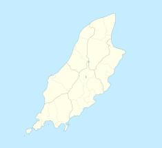
Creg-ny-Baa (English: /ˌkrɛɡnəˈbɑː/, Manx: [ˈkʰɾɛɡ nə ˈbɛ]; 'rock of the cow')[1] is located between the 3rd Milestone and 4th Milestone of the primary A18 Snaefell Mountain Road and the road junction with the secondary B12 'Creg-ny-Baa Back-Road',[2] in the parish of Kirk Onchan in the Isle of Man.
- ^ Place Names of The Isle of Man – Da Ny Manninee Dooie Volume Four Sheading of Garff (Kirk Maughold & Ramsey, Kirk Lonan and Kirk Connchan) page 419 Kirk Onchan by George Broderick (1999) Manx Place- Name Survey, Max Niemeyer Verlag Tubingen ISBN 3-484-40138-9 (Gesamtwerk) 3-484-10132-X Druck: Das Weihert-Druck GmbH Darmstadt, Eiband: Siegfried Geiger, Ammerbuch “….Creg ne baa ....small area round the road junction at 3787 in SC3981”
- ^ An Illustrated Encyclopaedia of the Isle of Man page 42 by David T.Webber Revised by Frank Cowin and F.J.Radcliffe;- Editor Gordon N. Kniveton (1997) The Manx Experience ISBN 1-873120-25-7 "A road junction on the Douglas to Ramsey Mountain Road leading to Laxey."
