| Crick | |
|---|---|
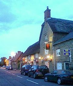
 Main Road, Crick (now bypassed) and the Red Lion Inn | |
Location within Northamptonshire | |
| Population | 1,886 (2011 Census) |
| OS grid reference | SP587726 |
| • London | 78 mi (126 km) |
| Civil parish |
|
| Unitary authority | |
| Ceremonial county | |
| Region | |
| Country | England |
| Sovereign state | United Kingdom |
| Post town | Northampton |
| Postcode district | NN6 |
| Dialling code | 01788 |
| Police | Northamptonshire |
| Fire | Northamptonshire |
| Ambulance | East Midlands |
| UK Parliament | |
Crick is a village in West Northamptonshire in England. It is close to the border with Warwickshire, six miles (ten kilometres) east of Rugby and 14 miles (23 km) northwest of Northampton. The villages of Crick and West Haddon were by-passed by the A428 main road from Rugby to Northampton when the Daventry International Rail Freight Terminal (DIRFT) was built in 1996. The terminal is a short distance east of junction 18 of the M1 motorway, which is next to Crick. Crick's population in the 2001 census was 1,460, increasing to 1,886 at the 2011 census.[1]
- ^ "Civil Parish population 2011". Neighbourhood Statistics. Office for National Statistics. Retrieved 1 July 2016.
