| Crummock Water | |
|---|---|
 Crummock Water from Red Pike | |
Location in the Lake District National Park | |
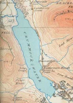
 map (1925) | |
| Location | Lake District, Cumbria |
| Coordinates | 54°33′N 3°18′W / 54.550°N 3.300°W |
| Type | Ribbon |
| Primary inflows | Buttermere Dubs |
| Primary outflows | River Cocker |
| Basin countries | United Kingdom |
| Max. length | 2.5 mi (4.0 km) |
| Max. width | 0.6 mi (0.97 km) |
| Surface area | 2.57 km2 (0.99 sq mi) |
| Max. depth | 140 ft (43 m) |
| Shore length1 | 6.26 mi (10.07 km) |
| Surface elevation | 96 m (315 ft) |
| Islands | 6 |
| 1 Shore length is not a well-defined measure. | |
Crummock Water is a lake in the Lake District in North West England. It is 2.5 miles (4.0 km) long, 0.6 miles (0.97 km) wide, 140 feet (43 m) deep, and has an area of 2.5 square kilometres (0.97 sq mi). The lake's primary inflow is Buttermere Dubs, itself the outflow of Buttermere, and its outflow is the River Cocker, which meets the River Derwent at Cockermouth before entering the Irish Sea at Workington. It is in the unitary authority of Cumberland and the ceremonial county of Cumbria. It is in the parish of Buttermere, and its western shore forms part of the western boundary of the parish.

