Cuautla
Heroic and Historic Cuautla | |
|---|---|
Municipal and rural | |
 Cuautla from the Morelos Museum | |
| Coordinates: 18°48′44″N 98°57′21″W / 18.81222°N 98.95583°W | |
| Country | |
| State | Morelos |
| Cuautla de las Ampilas | 1585 |
| Cuautla | April 4, 1829 |
| Government | |
| • Municipal President | Jesús Corona Damián (Juntos Haremos Historia) |
| Area | |
| • Municipal and rural | 153.651 km2 (59.325 sq mi) |
| • Metro | 1,037.30 km2 (12 sq mi) |
| Population (2020)[2] | |
| • Municipal and rural | 157,336 (city) 187,118 (municipality) |
| • Metro | 434,187[1] |
| Time zone | UTC-6 (Central) |
| Area code | 735 |
| Website | http://www.cuautla.gob.mx |
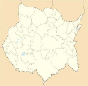
Cuautla (Nahuatl pronunciation: [ˈkʷaʍt͡ɬa], meaning "where the eagles roam"), officially La heroica e histórica Cuautla, Morelos (The Heroic and Historic Cuautla, Morelos) or H. H. Cuautla, Morelos, is a city and municipality in the Mexican state of Morelos, about 104 kilometers south of Mexico City. In the 2010 census the city population was 154,358.[3] The municipality covers 153.651 km2 (59.325 sq mi). Cuautla is the third most populous city in the state, after Cuernavaca and Jiutepec. The city was founded on April 4, 1829.[4] The 2020 population figures were 187,118 inhabitants for the municipality and 157,336 inhabitants for the city of Cuatula.[2]
The Cuautla Metropolitan Area, the second largest in Morelos, comprises the municipalities of Cuautla, Yautepec, Ayala, Yecapixtla, Atlatlahucan, and Tlayacapan. It covers 1,037.30 km2 (400.50 sq mi), which represents 21.26% of the state's total area. The metropolitan population (2010) is 434,187.[5]
- ^ COESPO, Retrieved Dec 18, 2018
- ^ a b "Censo de Poblacion y Vivienda". inegi.org.mx. INEGI. Retrieved February 22, 2021.
- ^ "Cuautla de Morelos (Cuautla, Morelos, Mexico) - Population Statistics, Charts, Map, Location, Weather and Web Information". www.citypopulation.de.
- ^ "Morelos - Cuautla". siglo.inafed.gob.mx. Retrieved May 11, 2020.
- ^ CEOSPO Morelos, Retrieved Dec 18, 2018

