Cuers-Pierrefeu Aerodrome Aérodrome de Cuers-Pierrefeu | |||||||||||
|---|---|---|---|---|---|---|---|---|---|---|---|
| Summary | |||||||||||
| Airport type | Public / Military | ||||||||||
| Serves | Cuers and Pierrefeu-du-Var | ||||||||||
| Elevation AMSL | 269 ft / 82 m | ||||||||||
| Coordinates | 43°14′51″N 6°7′38″E / 43.24750°N 6.12722°E | ||||||||||
| Maps | |||||||||||
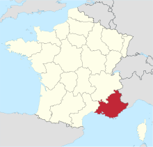
 Provence-Alpes-Côte d'Azur in France | |||||||||||
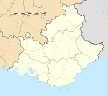
Location in Provence-Alpes-Côte d'Azur region | |||||||||||
 | |||||||||||
| Runways | |||||||||||
| |||||||||||
Cuers-Pierrefeu Aerodrome (French: Aérodrome de Cuers-Pierrefeu) (ICAO: LFTF) is a aerodrome in the Var department of the region of Provence-Alpes-Côte d'Azur, France.[2]
It is home of the Aéroclub du Var.
- ^ LFTF – Aérodrome de Cuers-Pierrefeu. AIP from French Service d'information aéronautique, effective 31 October 2024.
- ^ "Aérodrome du Cuers-Pierrefeu, Circulation Aéronautique Publique (CAP)" (PDF). Prefecture du Var. January 2020. Retrieved 5 August 2023.
