Cullman County | |
|---|---|
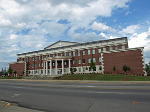
 Cullman County Courthouse in Cullman | |
 Location within the U.S. state of Alabama | |
 Alabama's location within the U.S. | |
| Coordinates: 34°08′00″N 86°52′00″W / 34.1333°N 86.8667°W | |
| Country | |
| State | |
| Founded | January 24, 1877 |
| Named for | John G. Cullmann |
| Seat | Cullman |
| Largest city | Cullman |
| Area | |
• Total | 755 sq mi (1,960 km2) |
| • Land | 735 sq mi (1,900 km2) |
| • Water | 20 sq mi (50 km2) 2.7% |
| Population (2020) | |
• Total | 87,866 |
• Estimate (2023) | 92,016 |
| • Density | 120/sq mi (45/km2) |
| Time zone | UTC−6 (Central) |
| • Summer (DST) | UTC−5 (CDT) |
| Congressional district | 4th |
| Website | www |
| |
Cullman County is a county located in the north central portion of the U.S. state of Alabama. As of the 2020 census, the population was 87,866.[1] Its county seat and largest city is Cullman.[2] Its name is in honor of Colonel John G. Cullmann.
Cullman County comprises the Cullman, AL Micropolitan Statistical Area, which is a component of the Birmingham-Hoover-Talladega, AL Combined Statistical Area.
It is served by TV stations and FM radio stations from both Huntsville and Birmingham and is part of the designated market area, or "DMA," of Birmingham. Cullman is a "moist" county in terms of availability of alcoholic beverages; the cities of Cullman, Good Hope, and Hanceville allow sale of alcohol and are "wet" and the rest of the county is dry.
- ^ "State & County QuickFacts". United States Census Bureau. Retrieved September 14, 2023.
- ^ "Find a County". National Association of Counties. Archived from the original on May 31, 2011. Retrieved June 7, 2011.
