| Cumberland | |
|---|---|
| Historic county | |
 | |
| Area | |
| • 1831 | 969,490 acres (3,923.4 km2)1831 Census cited in Vision of Britain – Ancient county data |
| • 1911 | 973,086 acres (3,937.94 km2) |
| • 1961 | 973,146 acres (3,938.18 km2) |
| Population | |
| • 1911 | 265,746 Vision of Britain – Cumberland population (density and area) |
| • 1961 | 294,303 |
| Density | |
| • 1911 | 0.27/acre (0.67/ha) |
| • 1961 | 0.3/acre (0.74/ha) |
| History | |
| • Origin | Historic |
| • Created | 12th Century |
| Status |
|
| Chapman code | CUL |
| Government | Cumberland County Council (1889–1974) |
| • HQ | Carlisle |
 Arms of Cumberland County Council | |
| Subdivisions | |
| • Type | Wards |
| • Units | |
 | |
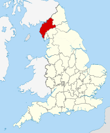
Cumberland (/ˈkʌmbərlənd/ KUM-bər-lənd) is a historic county in North West England. The historic county is bordered by Northumberland to the north-east, County Durham to the east, Westmorland to the south-east, Lancashire to the south, and the Scottish counties of Dumfriesshire and Roxburghshire to the north. The area includes the city of Carlisle, part of the Lake District and North Pennines, and the Solway Firth coastline.
Cumberland had an administrative function from the 12th century until 1974, when it was subsumed into Cumbria with Westmorland as well as parts of Yorkshire and Lancashire. It gives its name to the unitary authority area of Cumberland, which has similar boundaries but excludes Penrith.


