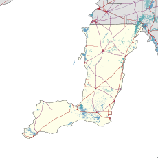
| Curramulka South Australia | |||||||||||||||
|---|---|---|---|---|---|---|---|---|---|---|---|---|---|---|---|
 Institute, built in 1885 | |||||||||||||||
| Coordinates | 34°41′46″S 137°42′39″E / 34.69611°S 137.71083°E[1] | ||||||||||||||
| Population | 304 (SAL 2021)[2] | ||||||||||||||
| Established | 12 September 1878 (town)[3] [4] | ||||||||||||||
| Postcode(s) | 5580[5] | ||||||||||||||
| Time zone | ACST (UTC+9:30) | ||||||||||||||
| • Summer (DST) | ACST (UTC+10:30) | ||||||||||||||
| Location | |||||||||||||||
| LGA(s) | Yorke Peninsula Council | ||||||||||||||
| Region | Yorke and Mid North[6] | ||||||||||||||
| County | Fergusson[1] | ||||||||||||||
| State electorate(s) | Narungga[7] | ||||||||||||||
| Federal division(s) | Grey[8] | ||||||||||||||
| |||||||||||||||
| Footnotes | Adjoining localities[1] | ||||||||||||||
Curramulka, nicknamed "the Currie", is a town in the Australian state of South Australia on the Yorke Peninsula. Curramulka is within easy driving distance of the coastal resort towns of Port Victoria and Port Vincent and is 15 kilometres (9.3 mi) north-east of Minlaton.
There are caves nearby.
- ^ a b c "Search results for 'Curramulka, LOCB' with the following datasets selected – 'Suburbs and localities', 'Counties', 'Government Towns', 'Hundreds', 'Local Government Areas', 'SA Government Regions' and 'Gazetteer'". Location SA Map Viewer. South Australian Government. Retrieved 12 September 2019.
- ^ Australian Bureau of Statistics (28 June 2022). "Curramulka (suburb and locality)". Australian Census 2021 QuickStats. Retrieved 28 June 2022.
- ^ Morgan, William (12 September 1878). "Untitled proclamation re the "Town of Curramulka"" (PDF). The South Australian Government Gazette. Government of South Australia. p. 728. Retrieved 11 September 2019.
- ^ "Curramulka South Australia". The Sydney Morning Herald. 8 February 2004. Retrieved 19 November 2009.
- ^ Australia Post – Postcode Search Archived 30 December 2012 at archive.today
- ^ "Yorke and Mid North SA Government region" (PDF). The Government of South Australia. Retrieved 17 April 2017.
- ^ Narungga (Map). Electoral District Boundaries Commission. 2016. Retrieved 1 March 2018.
- ^ "Federal electoral division of Grey" (PDF). Australian Electoral Commission. Retrieved 24 July 2015.
