This article needs additional citations for verification. (February 2024) |
 An aerial view of the island | |
| Geography | |
|---|---|
| Location | between Buzzards Bay and Vineyard Sound |
| Coordinates | 41°25′8″N 70°56′2″W / 41.41889°N 70.93389°W |
| Archipelago | Elizabeth Islands |
| Major islands | Penikese Island and Nashawena Island |
| Area | 2.35 km2 (0.91 sq mi) |
| Length | 1.5 mi (2.4 km) |
| Width | .75 mi (1.21 km) |
| Highest elevation | 154 ft (46.9 m) |
| Highest point | Lookout Hill |
| Administration | |
United States | |
| State | Massachusetts |
| County | Dukes |
| Town | Gosnold |
| Demographics | |
| Population | 52 |
| Pop. density | 23.32/km2 (60.4/sq mi) |
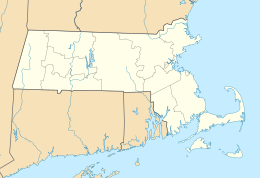
Cuttyhunk Island[1] is the outermost of the Elizabeth Islands in Massachusetts. A small outpost for the harvesting of sassafras was occupied for a few weeks in 1602, arguably making it the first English settlement in New England. Cuttyhunk is located between Buzzards Bay to the north and Vineyard Sound to the south. Penikese Island and Nashawena Island are located to the north and east respectively.
The island has a land area of 580 acres (0.91 sq mi; 2.3 km2), and a population of 52 persons as of the 2000 census. It is the fourth largest in area of the Elizabeth Islands and home to the village of Cuttyhunk. It lies entirely within the town of Gosnold.[2]
- ^ U.S. Geological Survey Geographic Names Information System: Cuttyhunk Island
- ^ "U.S. Census website". Retrieved 2020-03-29.

