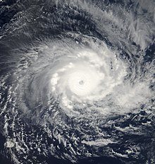
 Cyclone Hudah on 31 March | |
| Meteorological history | |
|---|---|
| Formed | 22 March 2000 |
| Dissipated | 9 April 2000 |
| Very intense tropical cyclone | |
| 10-minute sustained (MFR) | |
| Highest winds | 220 km/h (140 mph) |
| Highest gusts | 280 km/h (175 mph) |
| Lowest pressure | 905 hPa (mbar); 26.72 inHg |
| Category 4-equivalent tropical cyclone | |
| 1-minute sustained (SSHWS/JTWC) | |
| Highest winds | 230 km/h (145 mph) |
| Lowest pressure | 905 hPa (mbar); 26.72 inHg |
| Overall effects | |
| Fatalities | 114 total |
| Areas affected | Madagascar, Mozambique |
| IBTrACS | |
Part of the 1999–2000 Australian region and South-West Indian Ocean cyclone seasons | |
Very Intense Tropical Cyclone Hudah was a powerful and destructive tropical cyclone that affected Southeast Africa in April 2000. It was the last in a series of three cyclones that impacted Madagascar during the year. Hudah first developed as a disturbance embedded within the monsoon trough on 22 March, within the Australian region cyclone basin. Moving westward as the result of a strong subtropical ridge to its south, the storm quickly intensified, and reached Category 2 cyclone intensity on 25 March before entering the Southwest Indian cyclone basin. For various reasons that remain unknown, the cyclone was only designated a name by the time it had crossed into the area of responsibility of the Regional Specialized Meteorological Center in Réunion. Nonetheless, Météo-France (MFR) assigned the name Hudah to the cyclone. An eye formed, and the storm intensified into a tropical cyclone on 27 March well to the southeast of Diego Garcia. On 1 April, the MFR upgraded it to a very intense tropical cyclone, estimating peak 10-minute winds of 225 km/h (140 mph). By contrast, the Joint Typhoon Warning Center (JTWC) estimated 1-minute winds of 235 km/h (146 mph). At this time, the MFR estimated the pressure to have been 905 hPa (mbar), making Hudah the most intense tropical cyclone worldwide in 2000. Cyclone Hudah maintained peak winds until making landfall just southeast of Antalaha, Madagascar on 2 April. It weakened greatly over land, but re-attained tropical cyclone status on 5 April after moving over the Mozambique Channel. Hudah reached 10-minute winds of 160 km/h (99 mph) by the time it made landfall on Mozambique near Pebane, Mozambique, on 8 April, and dissipated by the next day.
While in the vicinity, Hudah brought moderate winds to Rodrigues, St. Brandon, and Tromelin Island. The cyclone affected the same parts of Madagascar that were previously impacted by cyclones Eline and Gloria. Waves reached at least 8 m (26 ft) in height along the coast. The storm was considered the worst to affect the Antalaha region in 20 years, where 90% of homes were destroyed. It was estimated that the storm left at least 100,000 people homeless in Madagascar, and there were 111 deaths. In Mozambique, damage was much less than expected, and the storm affected areas farther north in the country than where Eline struck. Heavy rainfall occurred along the coast, but was insufficient to cause river flooding. Strong winds damaged roofs and downed trees, mostly around Pebane, and the storm killed three people.