Cypress Park | |
|---|---|
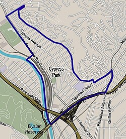
 Boundaries of Cypress Park as drawn by the Los Angeles Times | |
| Coordinates: 34°05′35″N 118°13′30″W / 34.09293°N 118.22504°W | |
| Government | |
| • City Council | Eunisses Hernandez |
| • State Assembly | Jesse Gabriel (D) |
| • State Senate | Maria Elena Durazo (D) |
| • U.S. House | Jimmy Gomez (D) |
Cypress Park is a densely populated neighborhood of 10,000+ residents in Northeast Los Angeles, California. Surrounded by hills on three sides, it sits in the valley created by the Los Angeles River and the Arroyo Seco. It is the site of the Rio de Los Angeles State Park, the Los Angeles River Bike Path and other recreational facilities. It hosts one private and four public schools.
The area was settled as a Spanish rancho which, after the Mexican–American War, became the property of an American landowner. After his death, Cypress Park was subdivided and established as a community in 1882.
There are four Los Angeles Historic-Cultural Monuments in Cypress Park.
The area is currently[as of?] undergoing rapid to moderate gentrification due to its close proximity to Highland Park, Downtown and various transportation hubs.
