This article needs additional citations for verification. (November 2013) |
Dacope
দাকোপ | |
|---|---|
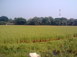
 Rice fields at Chalna | |
 | |
| Coordinates: 22°34.3′N 89°30.7′E / 22.5717°N 89.5117°E | |
| Country | |
| Division | Khulna |
| District | Khulna |
| Area | |
| • Total | 991.56 km2 (382.84 sq mi) |
| Population (2011) | |
| • Total | 152,316 |
| • Density | 150/km2 (400/sq mi) |
| Time zone | UTC+6 (BST) |
| Website | dakop |
Dacope (Bengali: দাকোপ) is an upazila of Khulna District in the Division of Khulna, Bangladesh. Dacope Thana was established in 1906 and was converted into an upazila in 1983.[1]
- ^ Shah Siddiqi (2012). "Dacope Upazila". In Sirajul Islam and Ahmed A. Jamal (ed.). Banglapedia: National Encyclopedia of Bangladesh (Second ed.). Asiatic Society of Bangladesh.