Daggett County | |
|---|---|
 Daggett County Courthouse in Manila, May 2008 | |
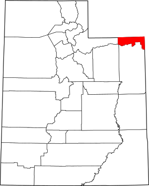
 Location within the U.S. state of Utah | |
 Utah's location within the U.S. | |
| Coordinates: 40°53′N 109°31′W / 40.89°N 109.51°W | |
| Country | |
| State | |
| Founded | January 7, 1918 |
| Named for | Ellsworth Daggett |
| Seat | Manila |
| Largest town | Manila |
| Area | |
• Total | 721 sq mi (1,870 km2) |
| • Land | 697 sq mi (1,810 km2) |
| • Water | 24 sq mi (60 km2) 3.3% |
| Population (2020) | |
• Total | 935 |
| • Density | 1.3/sq mi (0.50/km2) |
| Time zone | UTC−7 (Mountain) |
| • Summer (DST) | UTC−6 (MDT) |
| Congressional district | 3rd |
| Website | www |
Daggett County (/ˈdæɡət/ DAG-ət) is a county in the northeastern corner of the U.S. state of Utah. As of the 2020 United States Census, the population was 935, making it the least populous county in Utah. Its county seat is Manila.[1] The county was named for Ellsworth Daggett, the first surveyor-general of Utah.[2] The small community of Dutch John, located near the state line with Colorado and Wyoming, became an incorporated town in January 2016.[3]
- ^ "Find a County". National Association of Counties. Archived from the original on May 31, 2011. Retrieved June 7, 2011.
- ^ "About Us". daggettcounty.org. Daggett County, Utah. Retrieved November 10, 2024.
- ^ "Certificate of Incorporation" (PDF). municert.utah.gov. State of Utah. July 31, 2015. Retrieved November 10, 2024.