| Dajia River | |
|---|---|
 | |
 | |
| Native name | 大甲溪 (Chinese) |
| Location | |
| Country | Taiwan |
| Physical characteristics | |
| Source | |
| • location | Nanhu Mountain |
| • elevation | 3,637 metres (11,932 ft) |
| Mouth | |
• location | Taiwan Strait |
| Length | 142 km (88 mi) |
| Basin size | 1,235.73 km2 (477.12 sq mi) |
| Discharge | |
| • average | 31 cubic metres per second (1,100 cu ft/s) |
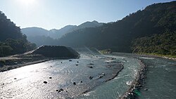
Dajia River (Chinese: 大甲溪; pinyin: Dàjiǎ Xī; Pe̍h-ōe-jī: Tāi-kah-khoe; lit. 'big shell river') is the fifth-longest river in Taiwan located in the north-central of the island. It flows through Taichung City for 142 km.[1] The sources of the Dajia are: Hsuehshan and Nanhu Mountain in the Central Mountain Range.[2] The Dajia River flows through the Taichung City districts of Heping, Xinshe, Dongshi, Shigang, Fengyuan, Houli, Shengang, Waipu, Dajia, Qingshui, and Da'an before emptying into the Taiwan Strait.[2]
Taiwan's Central Cross-Island Highway runs along the Dajia River from Heping to Dongshih. The Taichung Beltway begins in Fongyuan and follows the Dajia through into Cingshuei.
The mountain streams of the upper Dajia River are the only habitats of the critically endangered landlocked Formosan salmon.
- ^ Philip Diller. "Taiwan Rivers and Watersheds". Archived from the original on 2007-12-14. Retrieved 2007-11-30.
- ^ a b "大安大甲流域(Da-an/Dajia River Basin)" (in Chinese). Retrieved 2007-11-30.