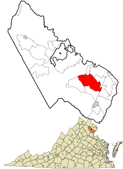
Dale City, Virginia | |
|---|---|
Census-designated place (CDP) | |
| Motto: The Friendliest Little City Around | |
 Location in Prince William County and the state of Virginia. | |
| Coordinates: 38°38′54″N 77°20′32″W / 38.64833°N 77.34222°W | |
| Country | United States |
| State | Virginia |
| County | Prince William |
| Area | |
• Total | 14.25 sq mi (39.0 km2) |
| • Land | 14.23 sq mi (39.0 km2) |
| • Water | 0.2 sq mi (0.0 km2) |
| Elevation | 230 ft (70 m) |
| Population (2020) | |
• Total | 72,088 |
| • Density | 5,156.9/sq mi (1,881.6/km2) |
| Time zone | UTC−5 (Eastern (EST)) |
| • Summer (DST) | UTC−4 (EDT) |
| ZIP code | 22193 |
| Area code(s) | 571, 703 |
| FIPS code | 51-21088[1] |
| GNIS feature ID | 1496866[2] |
Dale City is a census-designated place (CDP) in Prince William County, Virginia, United States, located 25 miles (40 km) south west of Washington, D.C. It is an annex of Woodbridge, Virginia. As of 2020, the total population was 72,088.[3]
The community is roughly bounded by Hoadly Road to the northwest, Prince William Parkway to the north, Smoketown Road to the northeast, Gideon Drive to the east, and Cardinal Drive to the south.[4]
- ^ "U.S. Census website". United States Census Bureau. Retrieved January 31, 2008.
- ^ "US Board on Geographic Names". United States Geological Survey. October 25, 2007. Retrieved January 31, 2008.
- ^ Tennessean, The. "Dale City CDP, Virginia Demographics and Housing 2020 Decennial Census". The Tennessean.
- ^ Shin, Annys (December 30, 2011). "Facing a Holiday Foreclosure". The Washington Post. p. B1, B5.