Dallington | |
|---|---|
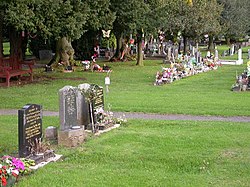
 Dallington Cemetery | |
| Coordinates: 52°14′38.64″N 0°55′22.49″W / 52.2440667°N 0.9229139°W | |
| Sovereign state | United Kingdom |
| Country | England |
| County | Northamptonshire |
| District | West Northamptonshire |
| Civil parish | Northampton |
| Area | |
| • Total | 0.04 sq mi (0.1 km2) |
| Elevation | 256 ft (78 m) |
Dallington is an area and former civil parish about 1.5 miles (2.4 km) northwest of the centre of Northampton, now in the parish of Northampton, in the West Northamptonshire district, in the ceremonial county of Northamptonshire, England. Dallington was formerly a separate village. At the 2011 census the population was listed in the Spencer ward of Northampton Council.
The villages name means 'farm/settlement connected with Daegel'.[1]
The Church of England parish church of Saint Mary the Virgin dates from 1207 and is a Grade II* listed building. It is near the site of a previous Saxon church.
Dallington Hall on Dallington Park Road is a Grade II* listed house built in 1720-30 for Sir Joseph Jekyll, Master of the Rolls in place of the original manor house owned by the Rainsford family (see Richard Raynsford). It was later owned by Earl Spencer[2] before becoming a hospital known as the Margaret Spencer Home of Rest.[3] It has now been divided into private apartments.
There was a short lived attempt to quarry iron ore in the parish in the early 1860s. The quarry ceased operation by 1863. It was on the west side of the railway to the north of Northampton Station and the site is now built over or covered by railway sidings. It had a horse -worked tramway to take the ore to the railway.[4]
Dallington is north-east of Duston, south of Kings Heath and north-west of St James End.
- ^ "Key to English Place-names".
- ^ "Properties with aristocratic connections for sale". Daily Telegraph. Archived from the original on 2 December 2011.
- ^ "Margaret Spencer Home of Rest". British Listed Buildings.
- ^ Tonks, Eric (1989). The Ironstone Quarries of the Midlands.Part 3: The Northampton Area. Cheltenham: Runpast. p. 153. ISBN 1-870754-03-4.
