Dalwangan
Báriyu Daluwangan | |
|---|---|
| Coordinates: 8°12′04.9″N 125°02′31″E / 8.201361°N 125.04194°E | |
| Country | Philippines |
| Province | Bukidnon |
| City | Malaybalay |
| District | North Highway District |
| Barangayhood | March 26, 1915 |
| Government | |
| • Type | Barangay Council |
| • Body | Sangguniang Barangay |
| • Chairman | Raul B. Pandong |
| Area | |
| • Total | 68.25 km2 (26.35 sq mi) |
| Elevation | 1,087 m (3,566 ft) |
| Population | |
| • Total | 7,004 |
| • Density | 100/km2 (270/sq mi) |
| Demonym | Daluwanganen |
| PSGC | 101312014[1] |
| IRA (2020) | Php 6,575,112[2] |
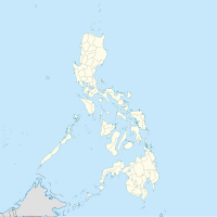
Dalwangan (Binukid: Báriyu Daluwangan) is a barangay west of Malaybalay City situated on the foothills of the Kitanglad Range, 12 kilometers west of the city proper. It is bounded to the north by Impalutao of the municipality of Impasugong, to the east by Patpat and Kalasungay, to the south by Capitan Angel and the Mount Kitanglad Range Natural Park, and to the west by Kibenton of Impasugong. According to the 2015 census, Dalwangan has a population of 7,004 people.[3]
- ^ "Philippine Standard Geographic Code for Dalwangan". Philippine Statistics Authority.
- ^ "CY 2020 Monthly internal revenue allotment for barangays, Region X, Bukidnon". Department of Budget and Management.
- ^ Census of Population (2015). Total Population by Province, City, Municipality and Barangay (PDF). Philippine Statistics Authority.

