| Damflask Reservoir | |
|---|---|
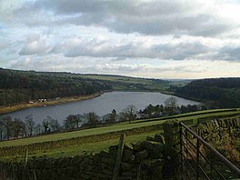
 Damflask Reservoir from Ughill Heights | |
| Location | Loxley, South Yorkshire |
| Coordinates | 53°24′45″N 1°35′05″W / 53.41239°N 1.58474°W |
| Type | reservoir |
| Basin countries | United Kingdom |
| Surface area | 47 ha (120 acres) |
| Max. depth | 27 m (89 ft) |
Damflask Reservoir is situated at grid reference SK277907 five miles (eight kilometres) west of the centre of Sheffield in the Loxley valley close to the village of Low Bradfield and within the city's boundaries. The hamlet of Stacey Bank is located to the east.[1] The reservoir has a capacity of 4,250.9 million litres (1,123.1 million gallons) and has a surface area of 47 hectares (120 acres) with a maximum depth of 27 metres (89 feet). The dam wall is approximately 400 metres (1,300 feet) wide with a height of 28 metres (92 feet).
- ^ Nunn, M. (2009). Loxley Valley and Beyond Through Time. Amberley Publishing. p. 43. ISBN 978-1-4456-2933-9. Retrieved 29 April 2019.
