This article needs additional citations for verification. (July 2007) |
Dangtu
当涂县 Tangtu | |
|---|---|
 | |
 | |
| Coordinates: 31°34′16″N 118°29′53″E / 31.571213°N 118.497972°E | |
| Country | China |
| Province | Anhui |
| Prefecture-level city | Ma'anshan |
| County seat | Gushu |
| Area | |
• Total | 1,002 km2 (387 sq mi) |
| Population (2020) | |
• Total | 446,991 |
| • Density | 450/km2 (1,200/sq mi) |
| Time zone | UTC+8 (CST) |
| Postal code | 243100 |
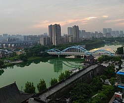
Dangtu County (simplified Chinese: 当涂县; traditional Chinese: 當涂縣; pinyin: Dāngtú Xiàn) is one of three counties under the jurisdiction of the prefecture-level city of Ma'anshan in the southeast of Anhui Province, China.[1][2]
Dangtu is one of the longest established counties in eastern China and formed part of the Taiping Prefecture during the Ming and Qing dynasties.
In September 2012, three towns of Bowang, Danyang, and Xinshi from Dangtu County were split to form Bowang District.[3]