Danville, Virginia | |
|---|---|
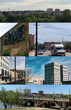
 Worsham Street overlook, Main & Ridge St. intersection, Masonic building (River City Towers), Martin Luther King Jr. Memorial Bridge, municipal building from Union Street, repurposed Dan River Fabrics "Home" sign.(Clockwise from the top) | |
| Nicknames: River City, City of Churches, DanVegas, D'ville | |
| Motto: Reimagine That | |
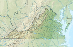
 Location in the Commonwealth of Virginia | |
Location of Danville in Virginia | |
| Coordinates: 36°35′14″N 79°24′16″W / 36.58722°N 79.40444°W | |
| Country | United States |
| State | Virginia |
| County | None (Independent city) |
| Government | |
| • Type | Council–manager |
| • Mayor | Alonzo Jones |
| • Vice Mayor | Gary P. Miller |
| • Council | Danville City Council |
| Area | |
| • Total | 43.70 sq mi (113.19 km2) |
| • Land | 42.80 sq mi (110.84 km2) |
| • Water | 0.90 sq mi (2.34 km2) |
| Elevation | 531 ft (162 m) |
| Population (2020) | |
| • Total | 42,590 |
| • Density | 970/sq mi (380/km2) |
| Demonym | Danvillian |
| Time zone | UTC−5 (EST) |
| • Summer (DST) | UTC−4 (EDT) |
| ZIP Code | 24540-24541, 24543 |
| Area code | 434 |
| FIPS code | 51-21344[2] |
| GNIS feature ID | 1492837[3] |
| Website | www |
Danville is an independent city in the Commonwealth of Virginia in the United States. The city is located in the Southside Virginia region and on the fall line of the Dan River. It was a center of tobacco production and was an area of Confederate activity during the American Civil War,[4] due to its strategic location on the Richmond and Danville Railroad. In April 1865 it briefly served as the third and final capital of the Confederacy before its surrender later that year.
Danville is the principal city of the Danville, Virginia Micropolitan Statistical Area. The Bureau of Economic Analysis combines the city of Danville with surrounding Pittsylvania County for statistical purposes. As of the 2020 census, the population was 42,590.[5] It is bounded by Pittsylvania County and Caswell County, North Carolina to the south. It hosts the Danville Otterbots baseball club of the Appalachian League.
Danville had an African American majority during the Reconstruction era and had African American political representatives of the Readjuster Party until after the Danville Massacre and Democrats regaining control locally and statewide.[6][7] The area again saw violence during the civil rights era.
- ^ "2019 U.S. Gazetteer Files". United States Census Bureau. Retrieved August 7, 2020.
- ^ "U.S. Census website". United States Census Bureau. Retrieved January 31, 2008.
- ^ "US Board on Geographic Names". United States Geological Survey. October 25, 2007. Retrieved January 31, 2008.
- ^ DeNordendorff, Charles. "Map of Danville Defences 1863". University of North Carolina at Chapel Hill. Retrieved June 8, 2016.
- ^ "Danville city, Virginia". United States Census Bureau. Retrieved January 26, 2022.
- ^ Schneider, Gregory (September 19, 2020). "Reckoning in a small town: Civil War meets civil rights in the Last Capital of the Confederacy". The Washington Post. Retrieved June 10, 2023.
- ^ Work Castle, Molly (October 19, 2021). "In the 1800s, election fraud and a massacre stopped black progress". Word in Black. Retrieved June 10, 2023.


