Darjeeling | |
|---|---|
|
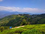
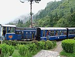
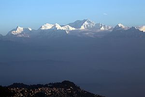
Clockwise from top-left: Tea estate in Darjeeling, Darjeeling Himalayan Railway, View of Kangchenjunga from Tiger Hill, View of Siliguri | |
 Location of Darjeeling district in West Bengal | |
| Coordinates: 26°52′N 88°18′E / 26.867°N 88.300°E | |
| Country | India |
| State | West Bengal |
| Division | Jalpaiguri |
| Headquarters | Darjeeling |
| Government | |
| • Subdivisions | Darjeeling Sadar, Mirik, Siliguri |
| • CD Blocks | Darjeeling Pulbazar, Jorebunglow Sukhiapokhri, Rangli Rangliot, Mirik, Naxalbari, Kharibari, Phansidewa, Matigara, Kurseong |
| • Lok Sabha constituencies | Darjeeling |
| • Vidhan Sabha constituencies | Darjeeling, Kurseong, Matigara-Naxalbari, Siliguri, Phansidewa |
| Area | |
• Total | 3,149 km2 (1,216 sq mi) |
| Population (2011) | |
• Total | 1,595,181 |
| • Density | 510/km2 (1,300/sq mi) |
| • Urban | 727,963 |
| Demographics | |
| • Literacy | 79.56 per cent |
| • Sex ratio | 970 ♂/♀ |
| Languages | |
| • Official | Bengali,[2][3] Nepali[3] |
| • Additional official | English[2] |
| Time zone | UTC+05:30 (IST) |
| Website | darjeeling |
Darjeeling District is the northernmost district of the state of West Bengal in eastern India in the foothills of the Himalayas. The district is famous for its hill station and Darjeeling tea. Darjeeling is the district headquarters. Kurseong, Siliguri and Mirik, three major towns in the district, are the subdivisional headquarters of the district. Kalimpong was one of the subdivisions but on 14 February 2017, it officially became a separate Kalimpong district.[4]
Geographically, the district can be divided into two broad divisions: the hills and the plains. The entire hilly region of the district comes under the Gorkhaland Territorial Administration, a semi-autonomous administrative body under the state government of West Bengal. This body covers the three hill subdivisions of Darjeeling, Kurseong and Mirik and the district of Kalimpong. The foothills of Darjeeling Himalayas, which comes under the Siliguri subdivision, is known as the Terai. The district is bounded on the north by Sikkim, on the south by Uttar Dinajpur district of West Bengal, southwest by Kishanganj district of Bihar state, on the southeast by Panchagarh district of Bangladesh, on the east by Kalimpong and Jalpaiguri districts, and on the west by easternmost Province No. 1 of Nepal. Darjeeling district has a length from north to south of 18 miles (29 km) and a breadth from east to west of 16 miles (26 km). As of 2011, it was the second least populous district of West Bengal (out of 19), after Dakshin Dinajpur.[5]
- ^ "About District - Darjeeling". Darjeeling District, Government of West Bengal. Retrieved 25 May 2024.
- ^ a b "Fact and Figures". Wb.gov.in. Retrieved 5 July 2019.
- ^ a b "52nd Report of the Commissioner for Linguistic Minorities in India" (PDF). Nclm.nic.in. Ministry of Minority Affairs. p. 85. Archived from the original (PDF) on 25 May 2017. Retrieved 5 July 2019.
- ^ Konar, Debashis (14 February 2017). "West Bengal CM congratulates people of Kalimpong district". The Times of Indial. Retrieved 18 February 2017.
- ^ "District Census Handbook: Darjeeling" (PDF). censusindia.gov.in. Registrar General and Census Commissioner of India. 2011. Archived (PDF) from the original on 18 April 2023. Retrieved 18 April 2023.


