This article needs additional citations for verification. (December 2007) |
Dartmouth | |
|---|---|
 Downtown Dartmouth skyline in 2024 | |
| Nicknames: City of Lakes, "The Darkside"[1] | |
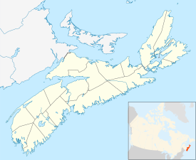
 Location of Dartmouth, shown in red | |
| Coordinates: 44°40′0″N 63°34′0″W / 44.66667°N 63.56667°W | |
| Country | Canada |
| Province | Nova Scotia |
| Municipality | Halifax |
| Founded | 1750 |
| Incorporated City | January 1, 1961 |
| Amalgamated with Halifax | April 1, 1996 |
| Neighbourhoods | Albro Lake, Bell Ayr Park, Brightwood, Burnside, Commodore Park, Crichton Park, Crystal Heights, Downtown Dartmouth, Ellenvale, Grahams Corner, Greenough Settlement, Harbourview, Highfield Park, Imperoyal, Keystone Village, Lancaster Ridge, Manor Park, Montebello, Nantucket, Port Wallace, Portland Estates, Portland Hills, Shannon Park, Southdale, Tam O'Shanter Ridge, Tufts Cove, Wallace Heights, Woodlawn, Woodside |
| Government | |
| • Governing Body | Halifax Regional Council |
| • Community Council | Harbour East - Marine Drive Community Council |
| • Districts | 3 - Dartmouth South - Eastern Passage
5 - Dartmouth Centre 6 - Harbourview - Burnside - Dartmouth East |
| Area | |
| • Total | 60.339 km2 (23.297 sq mi) |
| Highest elevation | 113 m (371 ft) |
| Lowest elevation | 0 m (0 ft) |
| Population | |
| • Total | 72,139 |
| • Density | 1,195/km2 (3,100/sq mi) |
| Demonym | Dartmouthian |
| Time zone | UTC−04:00 (AST) |
| • Summer (DST) | UTC−03:00 (ADT) |
| Postal code span | B2V to B2Z, B3A-B |
| Area code | 902 |
| Telephone Exchanges | 433-5, 460-6, 468-9, 481 |
| NTS Map | 11D12 Halifax |
| GNBC Code | CAIYJ[3] |
Part of a series about Places in Nova Scotia | |
Dartmouth (/ˈdɑːrtməθ/ DART-məth) (Scottish-Gaelic: Baile nan Loch) is a built-up community of Halifax Regional Municipality, Nova Scotia, Canada. Located on the eastern shore of Halifax Harbour, Dartmouth has 72,139 residents as of 2021.
- ^ "JOHN DeMONT: Something's blooming on the Darkside - Local Xpress". Archived from the original on 2016-08-08. Retrieved 2016-06-19.
- ^ "2001 Census Profile: Dartmouth, Nova Scotia". Statistics Canada. Retrieved February 20, 2020.
- ^ "Dartmouth". Geographical Names Data Base. Natural Resources Canada.

