Davik Municipality
Davik herad | |
|---|---|
| Daviken herred (historic name) | |
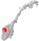
 Sogn og Fjordane within Norway | |
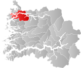
 Davik within Sogn og Fjordane | |
| Coordinates: 61°53′29″N 05°31′50″E / 61.89139°N 5.53056°E | |
| Country | Norway |
| County | Sogn og Fjordane |
| District | Nordfjord |
| Established | 1 Jan 1838 |
| • Created as | Formannskapsdistrikt |
| Disestablished | 1 Jan 1964 |
| • Succeeded by | Bremanger, Eid, and Vågsøy |
| Administrative centre | Davik |
| Area (upon dissolution) | |
| • Total | 655 km2 (253 sq mi) |
| Population (1964) | |
| • Total | 3,437 |
| • Density | 5.2/km2 (14/sq mi) |
| Time zone | UTC+01:00 (CET) |
| • Summer (DST) | UTC+02:00 (CEST) |
| ISO 3166 code | NO-1442[1] |
Davik is a former municipality in the traditional district of Nordfjord in the old Sogn og Fjordane county (now Vestland), Norway. The 654-square-kilometre (253 sq mi)[2] former municipality existed from 1838 until 1964 and it encompassed all the lands surrounding the outer part of the large Nordfjorden on both sides of the fjord. Davik was located in parts of the present-day municipalities of Kinn, Bremanger, and Stad. The administrative center of the former municipality was the village of Davik which is located on the southern shore of the Nordfjorden, although some of the municipal services were based out of the village of Bryggja on the north side of the fjord, since that village was the largest village in Davik municipality.[3]

Davik Church was the main church for the municipality, and it was located in the village of Davik, in the central part of the municipality. Rugsund Church (in the village of Rugsund) served the western part of the municipality and Ålfoten Church (in the village of Ålfoten) served the eastern part of the municipality.
- ^ Bolstad, Erik; Thorsnæs, Geir, eds. (26 January 2023). "Kommunenummer". Store norske leksikon (in Norwegian). Kunnskapsforlaget.
- ^ Helland, Amund (1901). "Daviken herred". Norges land og folk: Nordre Bergenhus amt (in Norwegian). Vol. XIV. Kristiania, Norway: H. Aschehoug & Company. p. 536. Retrieved 28 September 2019.
- ^ "Komunehistoria i Bremanger" (in Norwegian). NRK. Archived from the original on 31 October 2013. Retrieved 29 October 2013.