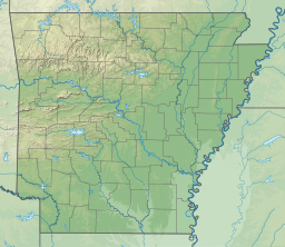
| DeGray Lake | |
|---|---|
 Dam and Lake | |
| Location | Clark / Hot Spring counties, Arkansas, United States |
| Coordinates | 34°12′53″N 93°06′41″W / 34.21472°N 93.11139°W [1] |
| Type | Reservoir |
| Primary inflows | Caddo River |
| Primary outflows | Caddo River |
| Basin countries | United States |
| Surface area | 13,800 acres (5,600 ha) |
| Average depth | 47 ft (14 m) |
| Max. depth | 200 ft (61 m) |
| Shore length1 | 207 mi (333 km) |
| References | [2] |
| 1 Shore length is not a well-defined measure. | |

DeGray Lake is a reservoir on the Caddo River constructed by the United States Army Corps of Engineers in Arkansas, 8 miles (13 km) from Arkadelphia. Arkansas Scenic Byway 7 is located on the eastern shore of the lake, and provides views of the lake, and also places to stay. DeGray Lake Resort State Park was opened in 1974 to encourage tourism and recreation on DeGray Lake.[3]
The DeGray Dam project, encompassing flood-control, power, and water-supply features is located in northern Clark County, Arkansas on the Caddo River approximately eight miles above its confluence with the Ouachita River. The project plan for DeGray Lake included the construction of the DeGray Dam with a height of 240 feet above the Caddo River, a dike that splits the Caddo River and Bayou de Roche, an outlet works, an uncontrolled spillway, and a powerhouse.[4]
- ^ "DeGray Lake Information" (PDF). United States Army Corps of Engineers. Archived from the original (PDF) on April 21, 2012. Retrieved March 9, 2012.
- ^ "DeGray Lake Fast Facts". United States Army Corps of Engineers. Archived from the original on April 21, 2012. Retrieved March 9, 2012.
- ^ Staff of the Arkansas Department of Parks and Tourism. The present DeGray project is a part of the comprehensive plan for flood control on the Ouachita River and Tributaries. Project purposes are power, flood control, water supply storage, navigation, public recreation, and pollution abatement. (September 10, 2008). "DeGray Lake Resort State Park". The Encyclopedia of Arkansas History and Culture. The Central Arkansas Library System. Retrieved March 9, 2012.
{{cite encyclopedia}}: CS1 maint: multiple names: authors list (link) - ^ U.S. Army Engineer Waterways Expiriment Station Vicksburg, Mississippi Dec 1961
