De Panne
La Panne (French) | |
|---|---|
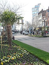
 De Panne town centre view | |
| Coordinates: 51°06′N 02°35′E / 51.100°N 2.583°E | |
| Country | |
| Community | Flemish Community |
| Region | Flemish Region |
| Province | West Flanders |
| Arrondissement | Veurne |
| Government | |
| • Mayor | Bram Degrieck (Het Plan - B) |
| • Governing party/ies | Het Plan -B, ACTIE, N-VA |
| Area | |
• Total | 26.63 km2 (10.28 sq mi) |
| Population (2018-01-01)[1] | |
• Total | 11,129 |
| • Density | 420/km2 (1,100/sq mi) |
| Postal codes | 8660 |
| NIS code | 38008 |
| Area codes | 058 |
| Website | www.depanne.be |
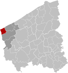
De Panne (Dutch pronunciation: [də ˈpɑnə] ; French: La Panne [la pan]) is a town and a municipality located on the North Sea coast of the Belgian province of West Flanders. There it borders France, making it the westernmost town in Belgium. It is one of the most popular resort town destinations within Belgium. The municipality includes the village of Adinkerke. On 1 January 2011, De Panne had a total population of 10,748 on a total area of 23.90 km2, which gives a population density of 449.7 inhabitants per km2.
- ^ "Wettelijke Bevolking per gemeente op 1 januari 2018". Statbel. Retrieved 9 March 2019.


